Life on the Open Road (April 2006 - May 2008)
The continuing saga of a single fulltime RVer who travels the western US. This is part one of my journey, from April 2006, when the blog started, to May 2008, when the blog continues at www.lifeontheopenroad.blogspot.com
About Me
- Name: Diana
I have been a full-time RVer for 20 years, primarily "boondocking," camping free without hookups, in the Western US. My batteries are charged solely by solar panels. I welcome your comments and emails. I also make trips to other countries, although not usually with the RV.
Saturday, July 29, 2006
Good Reason to Be Mobile #2
Hot, Hot, Hot in the valley below!
Where, oh where, can a codger go?
Up to a mountain pass, quick, quick, quick
Solves the problem smooth and slick.
For every thousand feet we climb,
Four degrees are left behind.
How fresh and cool the mountain air feels;
How sweet it is to live on wheels.
Tuesday, July 18, 2006
Bears, Icebergs, and a Scary Hike
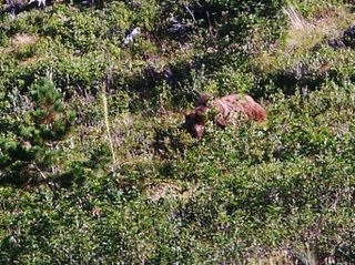
For years, I have wanted to hike to Iceberg Lake. It’s a long hike for me (10 miles round trip), and I kept thinking I’d be too old if I didn’t do it soon. The trail has been closed for the past 5 days because of grizzly bear activity, but this morning it was finally open. I took off up the trail, and all was well until a mile in, when grizzly bears were spotted on both sides of the trail. Lots of people turned back, but since I’m not getting any younger, I quickly took a picture and hurried on.
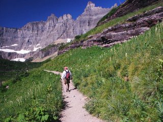
I caught up with 3 very nice, brave guys from Ohio, and stuck with them the whole way. We got to the lake just fine and it was a beautiful hike. Lots of wildflowers, including bear grass, on the trail, and icebergs in the lake.

However, this was supposed to be a very popular trail, and when no one else showed up, we realized they must have closed the trail again. Uh-oh... I had been counting on lots of human traffic to keep the bears away.
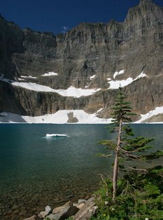
The trip back was a little scary, but we were rescued half-way by a ranger who escorted us down. And he didn’t even yell at us. He did point out a big pile of bear poop that we had stepped over on the way up. These rangers really enjoy looking at poop.

Monday, July 17, 2006
More Beautiful Hikes

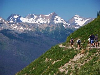
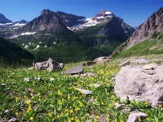
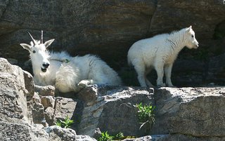
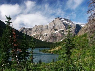
Yesterday, I took a 2-boat trip across Swiftcurrent Lake and Lake Josephine. From there I hiked to Grinnell Lake. (1st picture) The boats make it easy to get into the heart of the park. A ranger/naturalist gave an interesting talk on the way over. The big question was, How did they get the boat to Lake Josephine? (There is a .2 mile hilly stretch between the lakes.) Helicopter? No. Disassemble and reassemble? No. The answer? They used a stream that flows only in the spring. It still took 12 college guys a week to shove the boat over.
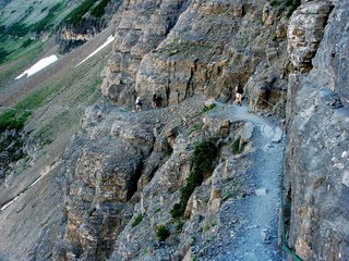
Today I hiked the first 3 miles of the Highline Trail. This trail starts across from the Visitors Center at Logan Pass, and basically goes along the side of a cliff. It’s full of great views, flowers and wildlife, including some very cooperative mountain goats.
Diana
Saturday, July 15, 2006
Lakes, Moose, and a Waterfall
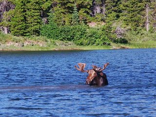
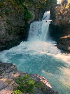
This morning I went up to the Many Glacier section of the park, and walked to a couple of lakes. At Fishercap Lake near the Swiftcurrent Motor Inn, I saw 2 large bull moose. They were feeding on some kind of aquatic plant by dunking their heads under the water, grabbing something, then coming back up, and chewing.
I then went walking along Swiftcurrent Lake and Lake Josephine. Nice views, spectacular cloud formations, and pretty flowers. Amazingly, I ran into someone I knew–Chuck Januska, a member of WIN.
In the afternoon, Randy and I walked to St. Mary Falls. Quite impressive. The only thing I didn’t like was the fact that the trail went downhill first. That always makes me nervous.
Tonight we went to a ranger program at the campground. We didn’t know what it would be about, which was good. The program was entitled "Scat Happens," and contained way too much information. For example, you can recognize elk scat by its "nipple-dimple formation." Apparently, this is a popular subject in the park. The number-one best selling book in the Visitors Center is called "Who Pooped in the Park?"
Diana
Friday, July 14, 2006
Glacier National Park Revisited
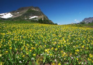


This morning we crossed the border back into the U.S. This time we are on the east side of the park, staying in St. Mary campground. We went up to the pass, and tried to hike to Hidden Lake, but the snow on the path was very slippery and we gave up. We did see some male big horn sheep (finally) and lots of flowers, especially Yellow Fawn Lilies, which bloom as the snow recedes. (The locals call them Glacier Lilies.)
Waterton Lakes National Park

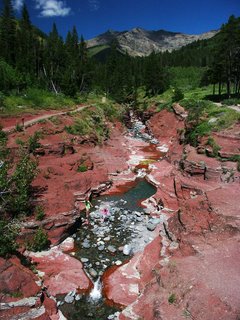
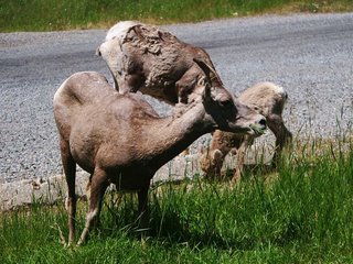
Yesterday, we went on a whirlwind tour of Canada’s portion of Waterton-Glacier International Peace Park. Deer have invaded the tiny townsite of Waterton. We must have seen 20, lolling around town, munching on the residents’ flowers. High above the town stands the Prince of Wales Hotel, a grand building, as you can see. We drove out to Red Rock Canyon where we saw two female and a baby big horn sheep.
The Canadian-U.S. border goes right through Upper Waterton Lake, and if you take a boat ride, you can actually see the border. Trees have been cut down to create a huge line, which goes for miles on either side of the lake, all the way up a mountain. I saw it on my helicopter ride a few weeks ago.
Tuesday, July 11, 2006
Canada's Glacier National Park
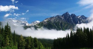


Today we took a day trip to Glacier National Park. While the Glacier National Park in the US has less than 50 glaciers, Canada’s park with the same name has over 400.
We first visited Rogers Pass, where these mountains provided almost insurmountable obstacles to the completion of Canada’s first transcontinental railroad. Avalanches were a huge problem, and the railroad now goes through a tunnel under Mount Macdonald. Avalanches are still a problem on the Trans-Canada Highway, which goes through the park here. Controlled avalanches are set off by shooting huge artillery shells from mobile howitzers. The first picture is taken from the pass.
We then hiked the Great Glacier Trail, which led to a very nice view of the Vaux Glacier on Mount Sir Donald (last picture). We also caught glimpses of the Great Glacier, otherwise known as Illecillewaet.
Sunday, July 09, 2006
Yoho National Park, Lake Louise, and Moraine Lake

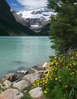
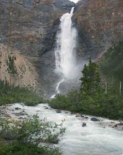
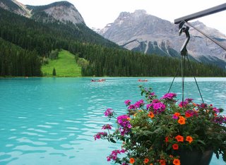
Barbara, Ron and I took a day trip to some of the great scenic spots in the area. We went to Moraine Lake and the Valley of the Ten Peaks first. It is impossible to take a bad picture here. By the time we got to Lake Louise, it was a little cloudier, but still beautiful.
On our way back through Yoho, we saw Takakkaw Falls, which pours down more than 1200 feet from a glacier into the Yoho River. We also stopped at Emerald Lake. Barbara and I were here as children and remember thinking then, as now, that the color is not emerald. It should be called Turquoise Lake.
Diana
Thursday, July 06, 2006
Kootenay and Banff National Parks
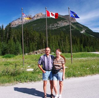

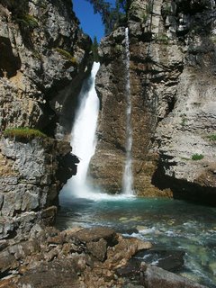
A day trip to Kootenay and Banff National Parks took us across the provincial boundary at the continental divide. Vast resources and territory were at stake when BC and Alberta established the line between them. The exact route of the continental divide was scrupulously marked.
While in Banff NP, we went on a great hike through Johnston Canyon to several beautiful waterfalls. The canyon is so narrow that a lot of the trail is on catwalks.
Canadian Wildlife

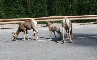
Where animals and progress collide, unexpected solutions and problems emerge. Here, an earth-filled wildlife overpass allows animals to cross the highway unscathed. But where’s the salt lick? Bighorn sheep are forced to stand in the middle of the road to lick the salt leftover from the winter salting of the roadway.

Randy's Independence Day Oration
We are not aimless drifters killing time ‘til time kills us. We are adventurers responding to the call of the wild, advancing confidently in the direction of our dreams. We are second-wave pioneers blazing trail to a new life style; perfecting the art of mobility, guiding our swift cozy wagons across mountains, desert and plains; settling briefly in the valleys of anywhere; letting night overtake us everywhere at home.
We are spiritual descendants of Kokopelli, Marco Polo, Johnny Appleseed, enjoying the land but owning it not! We have learned that journey is more important than destination. We lose ourselves in far-flung places, like Invermere, because it is a good way to find ourselves.
We’re the sprouting seed of a brand new breed,
Living simple, light and lean.
Living happy and free as wild Cherokee
In cozy little living machines;
A life that’s bold with oneself in control
And clusters of friends in affection;
Reinventing the tribe and helping revive
Our long lost natural connection.
Choosing sunlight’s glow over ice and snow,
Acceptance over sorrow,
Adventurous game over riches and fame
And today over "iffy" tomorrow.
We prove the truth of Tolkien’s words:
Not all who wander are lost.
Tuesday, July 04, 2006
Airplane Tour of Invermere, BC
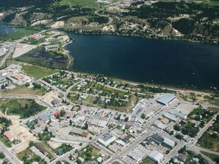
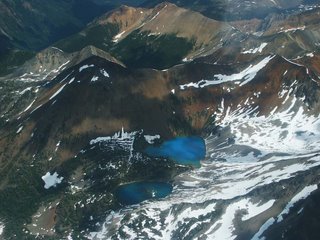
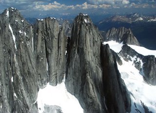
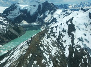

Gee, I hope this doesn't become an addiction. I just couldn't resist another air tour, this one in a small airplane of the mountains just west of Invermere.
In the first picture, you may be able to make out all of our rigs parked in our temporary home which has became permanent, as once again our confirmed parking space fell through. We are about 1/3 up and 1/3 from the right side.
The third picture is the spires of Bugaboo Park, and the fourth is the Lake of the Hanging Glacier. There were many more glaciers than were in Glacier National Park. One large one is in the last picture.
Diana

